Hiking Trails Near Frederick
Frederick Provides 100+ Miles of Hiking Trails
Frederick County contains 100+ miles of marked hiking trails ranging from 0.5-mile nature loops to 27-mile backpacking routes. Trails cover elevations from 200 feet to 1,900 feet with difficulty levels for every ability.
Top Hiking Trails Within 1 Hour of Frederick
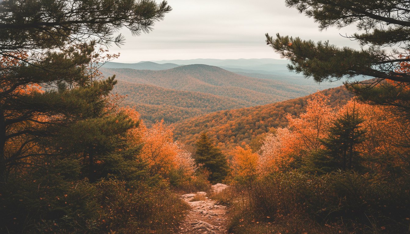
Frederick County sits at the intersection of three distinct physiographic provinces: the Appalachian Mountains, the Piedmont Plateau, and the Atlantic Coastal Plain. This diverse geology creates varied hiking experiences within a short drive of downtown Frederick. From gentle nature walks to strenuous mountain ascents, the region offers trails for every skill level and interest.
Ten standout trails showcase the best of Frederick County's landscape—from Civil War battlefields to panoramic mountain overlooks. Each trail below includes difficulty rating, distance, and elevation data to help you choose the right hike for your ability level.
Featured Hiking Trails Near Frederick
1. Annapolis Rock via Appalachian Trail
Difficulty: Moderate | Distance: 5.0 miles round-trip | Elevation Gain: 800 feet
Annapolis Rock stands as one of the most popular hiking destinations near Frederick. The trail follows the famous Appalachian Trail from the Route 40 trailhead near Greenbrier State Park, ascending through a mature hardwood forest featuring oak, hickory, and mountain laurel.
The viewpoint sits at 1,430 feet elevation on a quartzite outcrop offering 30-mile views across the Cumberland Valley. On clear days, the vista includes the town of Boonsboro, distant mountains, and agricultural landscapes. The rocky summit provides perfect picnic spots and sunset viewing.
2. Cunningham Falls Lower Trail
Difficulty: Easy | Distance: 1.0 mile round-trip | Elevation Gain: 50 feet
The Lower Trail offers the easiest route to Maryland's largest cascading waterfall. A boardwalk and paved path lead to the base of the 78-foot falls, making this wheelchair-accessible route available to visitors of all abilities.
The trail begins at the Cunningham Falls State Park visitor center and follows Big Hunting Creek through hemlock and rhododendron forests. Interpretive signs explain the geology and ecology of the falls. Summer visitors enjoy the cool mist while winter creates beautiful ice formations.
3. Chimney Rock Trail in Catoctin Mountain Park
Difficulty: Moderate | Distance: 4.0 miles round-trip | Elevation Gain: 650 feet
The Chimney Rock Trail forms a loop connecting to Wolf Rock and Chimney Rock overlooks, beginning from the Central Trailhead on Park Central Road. Hikers pass through second-growth forest recovering from historic logging and fire.
Chimney Rock itself consists of massive boulders stacked to create a natural stone tower. The viewpoint looks south across the Frederick Valley with visibility reaching 25 miles on clear days. Wolf Rock features unique rock formations popular with rock climbers, and the trail connects to longer loops for extended hikes.
4. Sugarloaf Mountain Summit Trail
Difficulty: Moderate | Distance: 2.5 miles round-trip | Elevation Gain: 600 feet
Sugarloaf Mountain rises 800 feet above the surrounding landscape as a distinctive quartzite monadnock. The Summit Trail begins from the East View parking area and ascends through forested slopes to the exposed rock summit.
The summit presents 360-degree views across Montgomery and Frederick counties. On clear days, the vista extends to Washington, D.C. and Baltimore. The exposed rock supports rare plant communities, and Strong Mansion at the mountain base offers a glimpse of 19th-century country estate life.
5. Monocacy Battlefield Gambrill Mill Trail
Difficulty: Easy | Distance: 2.0 miles round-trip | Elevation Gain: 100 feet
The Gambrill Mill Trail loops through Monocacy National Battlefield, site of the "Battle That Saved Washington" (July 9, 1864). The trail passes the historic Gambrill Mill, Confederate artillery positions, and the Monocacy River, with interpretive markers explaining the battle's significance.
The path follows a combination of mowed grass and wooded sections along the river. Birdwatchers spot herons, kingfishers, and bald eagles along the waterway. The flat terrain makes this trail suitable for families and history enthusiasts.
6. Thurmont Vista Trail
Difficulty: Moderate | Distance: 3.5 miles round-trip | Elevation Gain: 700 feet
The Thurmont Vista Trail begins from Park Central Road and climbs to one of the best viewpoints in Catoctin Mountain Park. The trail features steep sections requiring scrambling over rocks, passing through diverse forest types including dry oak-pine ridges and moist coves.
The vista overlooks the town of Thurmont and the rolling farmland of the Frederick Valley. Camp David, the presidential retreat, sits somewhere in the forested mountains visible from the overlook. The trail connects to the Cat Rock Trail for extended hiking options.
7. C&O Canal Towpath: Brunswick to Harpers Ferry
Difficulty: Easy | Distance: 6.0 miles one-way | Elevation Gain: Minimal
The Chesapeake & Ohio Canal National Historical Park maintains 184 miles of flat, packed towpath between Georgetown and Cumberland. The Brunswick to Harpers Ferry section offers scenic river views, historic locks, and easy walking on a nearly level grade atop the original mule towpath.
Hikers pass through the historic town of Brunswick, cross the Potomac River on a railroad bridge with pedestrian access, and reach Harpers Ferry, West Virginia. The route features views of the confluence of the Potomac and Shenandoah rivers, with one-way hiking and train return options available.
8. South Mountain State Battlefield Trail
Difficulty: Moderate | Distance: 3.0 miles round-trip | Elevation Gain: 500 feet
South Mountain State Battlefield preserves the site of a crucial Civil War engagement (September 14, 1862). The trail climbs from the Fox's Gap parking area to the mountain ridge where fierce fighting occurred, with interpretive markers describing the battle that paved the way for Antietam.
The path ascends through mountain laurel and oak forest. At the summit, hikers find monument stones marking Union and Confederate positions. The trail connects to the Appalachian Trail at the ridge crest, and fall hikers experience both historic significance and beautiful foliage.
9. Fountain Rock Nature Trail
Difficulty: Easy | Distance: 1.5 miles | Elevation Gain: 100 feet
Fountain Rock Nature Center maintains a network of short trails perfect for families and beginner hikers. The Nature Trail loops through meadows, forest, and past a historic limestone kiln on flat, well-marked paths that accommodate strollers and young children.
The nature center provides educational displays about local wildlife and habitats. Seasonal programs include guided walks, maple syrup demonstrations, and pond studies. Spring wildflowers create colorful displays along the woodland sections.
10. Frederick Watershed Trails
Difficulty: Hard | Distance: 5-20 miles (various loops) | Elevation Gain: 1,000+ feet
The Frederick Watershed encompasses 7,400 acres of protected forest land with 30+ miles of multi-use trails ranging from moderate stream valley walks to strenuous ridge climbs. The watershed serves as Frederick's drinking water supply, requiring visitors to practice Leave No Trace principles.
The trails attract experienced hikers seeking solitude and challenging terrain. The Crampton's Gap Trail climbs to 1,400 feet with views of the Middletown Valley, while the Hamburg Road loop follows historic logging roads through mature forest. Trail markers vary in quality, so carrying a map remains essential.
Hiking Season and Safety
Frederick County enjoys a four-season hiking climate. Spring (March-May) brings wildflowers and waterfalls fed by snowmelt. Summer offers lush green forests but requires early starts to avoid heat. Fall (September-November) delivers the most popular hiking season with cool temperatures and spectacular foliage. Winter provides solitude and ice formations but requires appropriate gear.
Always carry water, snacks, and navigation tools. Cell service drops in valleys and remote areas, and mountain trails feature rocky sections requiring sturdy footwear. Tick prevention matters year-round in this Lyme disease endemic area. After hiking, many visitors head to downtown Frederick restaurants for well-deserved meals.
Tips & Guidelines
Check Trail Conditions Before You Go
Maryland State Parks post trail conditions online. Spring rains create muddy conditions on many paths. Winter ice requires microspikes for mountain trails.
Bring the 10 Essentials
Every hike requires navigation, sun protection, insulation, illumination, first aid, fire starter, repair kit, nutrition, hydration, and emergency shelter. Even short trails present unexpected challenges.
Start Early for Popular Trails
Cunningham Falls and Annapolis Rock fill parking lots by 10 AM on weekends. Sunrise hikes guarantee parking and cooler temperatures. Weekday hikes offer solitude on normally busy trails.
Related Articles
Frequently Asked Questions
What is the best trail for beginners? ▼
The Catoctin Furnace Trail offers a flat 1-mile loop perfect for beginners and families. The Cunningham Falls Lower Trail provides boardwalk access to the waterfall with minimal elevation gain.
Do any trails allow dogs? ▼
Most Frederick County trails permit leashed dogs. Cunningham Falls and Gambrill State Parks welcome dogs on 6-foot leashes. The C&O Canal Towpath allows dogs throughout its 184-mile length.
Which trail has the best views? ▼
Annapolis Rock via the Appalachian Trail delivers panoramic views of the Cumberland Valley from 1,430 feet elevation. The Chimney Rock overlook in Catoctin Mountain Park offers dramatic cliff-top vistas.
Want to explore more?
← Return to Best Parks in FrederickDiscover More Frederick Outdoor Activities
Explore biking trails, botanical gardens, and scenic drives near Frederick, Maryland.
View All Attractions