## Challenging Trails for Experienced Hikers
Frederick County delivers exceptional hiking opportunities. Experienced hikers discover demanding routes within easy reach of historic downtown Frederick MD. These 7 trails test endurance, technical skill, and preparation.
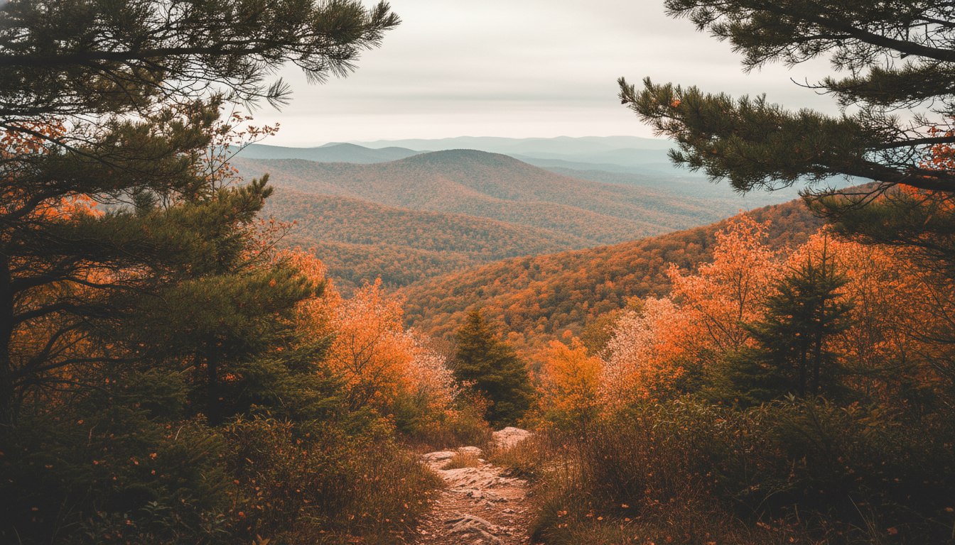
## Catoctin Mountain Extended Loop
**Distance**: 8.5 miles | **Elevation Gain**: 1,850 feet | **Difficulty**: Strenuous
Catoctin Mountain Park contains Maryland's most demanding hiking terrain. The Extended Loop combines Chimney Rock, Wolf Rock, and Thurmont Vista into a single grueling circuit.
**Trail Characteristics**:
- Rock scrambles require hand-over-hand climbing
- Exposed cliff edges demand caution
- Steep ascents exceed 20% grade in sections
- Limited water sources along the route
**Preparation Requirements**: Carry 3+ liters of water. Trekking poles stabilize loose rock sections. Sturdy boots with ankle support prevent injuries. This route demands 6-7 hours of continuous hiking.
## Annapolis Rock via Appalachian Trail
**Distance**: 5.0 miles | **Elevation Gain**: 1,100 feet | **Difficulty**: Moderately Strenuous
The Appalachian Trail crosses South Mountain near Frederick. Annapolis Rock provides panoramic views of the Cumberland Valley. The steep approach challenges even fit hikers.
**Technical Elements**:
- Sustained climbing from the trailhead
- Rocky footbed requires careful foot placement
- Exposed summit with cliff drop-offs
- Limited shade on the final approach
**Best Conditions**: Spring and fall offer ideal temperatures. Summer heat amplifies the difficulty significantly. Early morning starts avoid crowds at this popular viewpoint.
## Black Rock Cliffs Circuit
**Distance**: 6.2 miles | **Elevation Gain**: 1,400 feet | **Difficulty**: Strenuous
Black Rock Cliffs tower above the surrounding landscape. The circuit route combines multiple trails for a demanding half-day adventure. Technical rock sections require scrambling skills.
**Route Highlights**:
- 200-foot cliff overlooks
- Boulder fields demand navigation attention
- Steep ravine crossings
- Dense forest with limited visibility
**Gear Recommendations**: Gloves protect hands during scrambles. A GPS device aids navigation where blazes fade. Emergency shelter provides protection if weather deteriorates.
## Sugarloaf Mountain Summit Trail
**Distance**: 4.8 miles | **Elevation Gain**: 950 feet | **Difficulty**: Moderately Strenuous
Sugarloaf Mountain rises as a monadnock south of Frederick. The Summit Trail climbs relentlessly from the base. Private ownership maintains excellent trail conditions.
**Climbing Profile**:
- Continuous ascent with minimal flat sections
- Rocky stairs carved into the mountainside
- Western summit offers best views
- Eastern approach provides gentler alternative
**Physical Demands**: The constant uphill grade stresses cardiovascular fitness. Quad strength proves essential for the descent. Plan 3-4 hours for the full circuit.
## Weverton Cliffs via AT
**Distance**: 6.8 miles | **Elevation Gain**: 1,250 feet | **Difficulty**: Strenuous
Weverton Cliffs deliver dramatic Potomac River views. The Appalachian Trail route climbs sharply from the river valley. This section tests hiking efficiency.
**Technical Challenges**:
- Steep switchbacks with loose gravel
- Cliff-edge trail sections
- Stream crossings after rain
- Limited bailout options
**Navigation Notes**: White blazes mark the AT clearly. Side trails access the cliffs directly. The return route follows the same path or connects to alternate trails.
## High Knob via Rocky Ridge Trail
**Distance**: 7.3 miles | **Elevation Gain**: 1,600 feet | **Difficulty**: Strenuous
High Knob represents Cunningham Falls State Park's most demanding peak. Rocky Ridge Trail lives up to its name with constant technical terrain.
**Terrain Features**:
- Large boulder fields slow progress
- Steep pitches require scrambling
- Dense mountain laurel encroaches on the trail
- False summits test morale
**Seasonal Considerations**: Fall delivers spectacular foliage views. Spring wildflowers line the lower sections. Winter ice makes rocks treacherous without traction devices.
## Lambs Knoll Extended Route
**Distance**: 9.2 miles | **Elevation Gain**: 1,750 feet | **Difficulty**: Very Strenuous
Lambs Knoll challenges hikers with distance and elevation combined. The extended route connects multiple trail systems across South Mountain State Park.
**Endurance Test**:
- Marathon distance with significant climbing
- Remote sections require self-sufficiency
- Multiple water crossings
- Complex trail junctions demand map skills
**Training Recommendation**: Attempt this route only after completing shorter difficult hikes successfully. Start before sunrise. Carry headlamps even for summer attempts.
## Safety Protocols for Advanced Hiking
Difficult hiking near Frederick demands respect. Proper preparation separates successful adventures from rescue situations.
**Essential Safety Practices**:
- Hike with partners on technical routes
- Carry the ten essentials for backcountry travel
- Know your limits and turn back when necessary
- Check trail conditions with park rangers
**Emergency Contacts**: Frederick County emergency services respond to mountain rescues. Cell coverage remains unreliable on ridges. A satellite communicator provides peace of mind.
## Physical Conditioning Requirements
These trails punish unprepared hikers. Specific fitness components enable safe completion.
**Required Fitness Elements**:
- Cardiovascular endurance for sustained climbing
- Leg strength for steep descents
- Core stability for balance on uneven terrain
- Ankle strength to prevent rolls on rocks
**Training Progression**: Start with moderate 5-mile hikes. Progress to 1,000-foot elevation gain routes. Build toward these difficult trails over several months.